


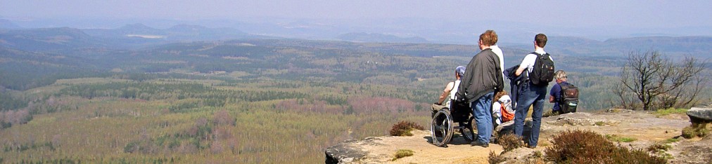

Nowadays there are an increasing number of paths in the national park region, which are accessible for people with physical handicaps. Those visitors that have sufficient perseverance and their own helpers can take whole- and half-day trips deep into untouched nature away from the tourist promenades. Also a number of beautiful look-outs can be reached this way. The Brand view, the “Kuhstall” at Neuer Wildenstein or a hike through Waldhusche in Hinterhermsdorf – there is a lot to discover!
R E C O M M O N D A T I O N S
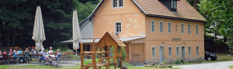
Around Pfaffenstein
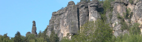
View of Pfaffenstein / Photo: Archive Nationalparkverwaltung, W. Langer
Route: road to Cunnersdorf / car park- meadow near Barbarine pinnacle – west-side of Pfaffenstein – “Steinerne Scheune” (stone barn) – car park
Distance: 3.3 km
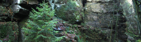
Through Waldhusche
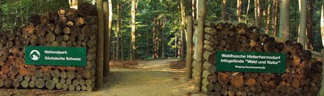
One of the entrances to Waldhusche / Photo: Archive Nationalparkverwaltung
Route: Hinterhermsdorf car park Buchenparkhalle – outdoor compound of Waldhusche – Beizehaus and back
Distance: 3.4 km
Through the Great Zschand to Zeughaus
The traditional Zeughaus restaurant / Photo: Archive Nationalparkverwaltung, K. Jäpelt
Route: Neumannmühle car park – Great Zschand – Zeughaus and back
Distance: 3.6 km
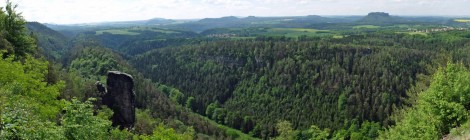
To Wildwiese
Panorama view from Wildwiese toward Schrammsteine / Photo: Archive Nationalparkverwaltung, K. Jäpelt
Route: Zahnsgrund – Wenzelweg – Wildwiese and back
Distance: 4.2 km
To Kuhstall on Neuer Wildenstein
The cave called “Kuhstall” on Neuer Wildenstein / Photo: Archive Nationalparkverwaltung, J. Weber
Route: Kirnitzsch Valley – Alte Straße – Neuer Wildenstein / Kuhstall and back
Distance: 4.2 km
To Brand view
View from Brand look-out / Photo: Archive Nationalparkverwaltung, K. Jäpelt
Route: Hohnstein – along Brandstraße to Brand view and back
Distance: 5.6 km
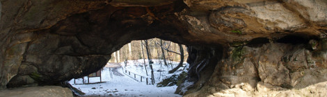
To the rock arch in Uttewalder Grund
Hiking in the gorge of Uttewalder Grund near Wehlen / Photo: Archive Nationalparkverwaltung
Route: Stadt Wehlen – Steinrückenweg – Uttewalder Grund gorge – Rock arch and back
Distance: 5 – 6 km
To the Upper Sluice near Hinterhermsdorf
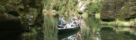
Gondola on the Kirnitzsch River at the Upper Sluice / Photo: Archive Nationalparkverwaltung
Route: Hinterhermsdorf – Neue Strasse – Wettinplatz – Upper Sluice boat station and back
Distance: 8 km


Comments are closed, but trackbacks and pingbacks are open.