


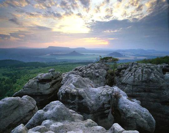
Evening view from the Silberwand (silver wall, Bohemian Switzerland) to the two Zschirnsteine / Photo: V. Sojka
Hiking Recommendation: Great and Small Zschirnstein: Kleingießhübel – Flügel K – Prölitzschweg – Old Děčínská road (Tetschener Strasse) – Zschirnsteinweg – Great Zschirnstein – Flügel B – Small Zschirnstein – Hirschgrundweg – Kleingießhübel (about 9 km, not strenuous)
The Great Zschirnstein at 561 m height is the highest peak in Saxon Switzerland. The spacious summit plateau is very flat and wooded. At the southern end of the Great Zschirnstein is the highest point, the Mittagsstein, at 562 m. At the Mittagsstein, a stone cliff drops about 80 m deep. From here you have a very impressive and perhaps the most comprehensive view of Saxon-Bohemian Switzerland. It opens up views into Bohemian Switzerland, like the High Schneeberg, as well as onto the peaks of Saxon Switzerland and the Ore Mountains. The Small Zschirnstein at 473 m is slightly lower and smaller in area than its neighboring brother, the Great Zschirnstein. From the top of this mesa hikers have a view of most of all the mesas in Saxon Switzerland.
Getting there: Busses 251 and 244b to Kleingießhübel go from Bad Schandau and the bus line 244a goes from Königstein (note season timetables).


